Upper Athabasca Region — Site UAR B2
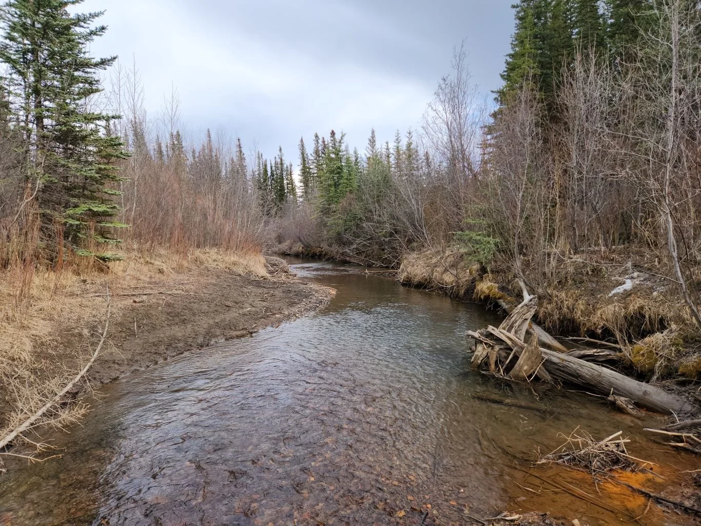
This site is located on Solomon Creek near its entry into the Athabasca River. Image taken on 2023/04/12.
Water Monitoring Data
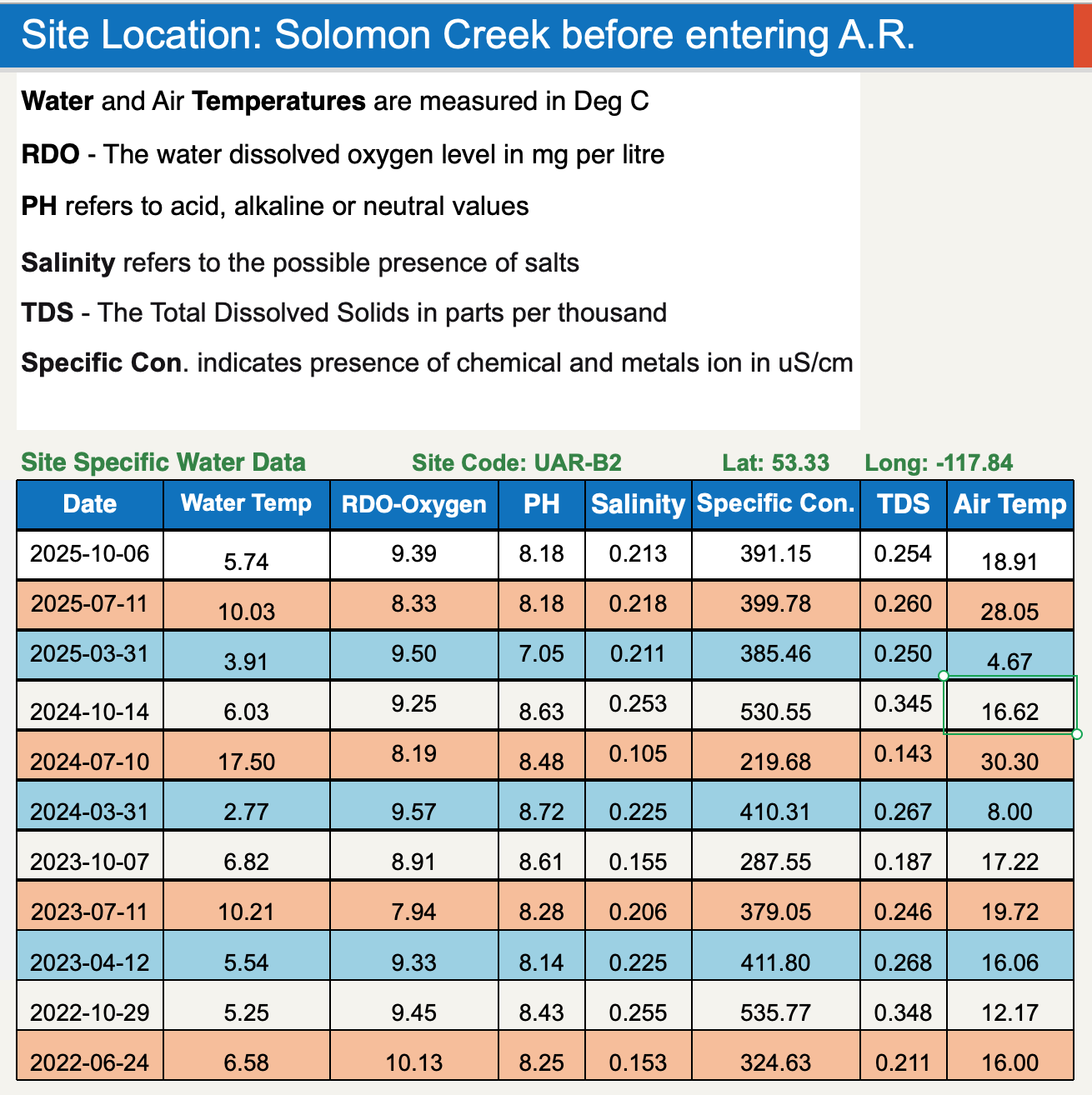
Site Coordinates
53.34, -117.84°
Traditional Knowledge
Get your own PDF copy of the Centre for Indigenous Environmental Resources’ Indigenous Climate Change Adaptation Planning Toolkit.
Learn More
Learn more about our Community Water Monitoring program.
Learn more about the conditions we monitor and safe baselines.