
Lower Athabasca Region — Site LAR K1
This site is located on the Muskeg River north of Fort McKay First Nation. Image taken at the site on 2023/04/06.
Water Monitoring Data
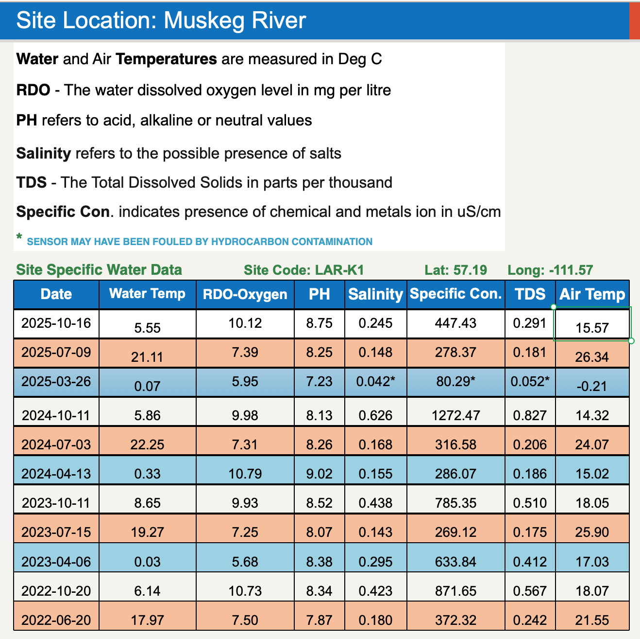
Site Coordinates
57.19°, -111.57°
Traditional Knowledge
Learn how to fillet a trout in this video from Fort McKay First Nation featuring Stan and his grandson.
Learn More
Learn more about our Community Water Monitoring program.
Learn more about the conditions we monitor and safe baselines.